Water Resource Development Projects
 |
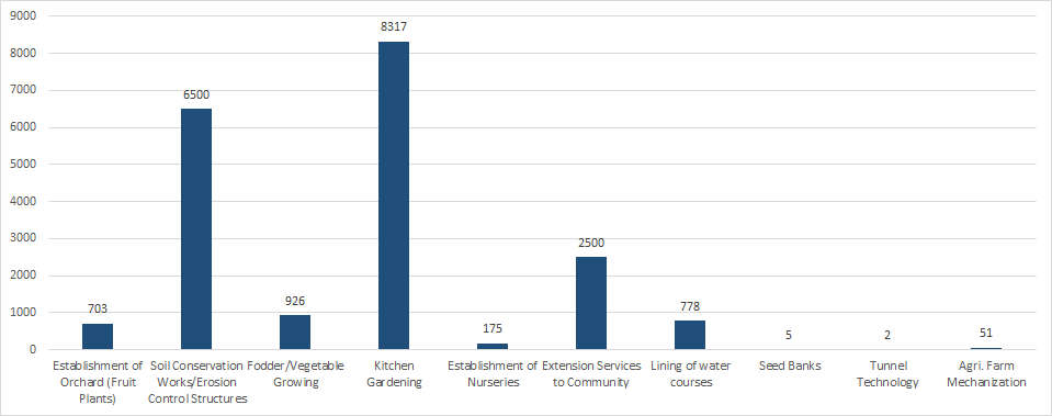
Land and Agriculture Development
 |
Livestock and Poultry Development

Forestry and Fisheries Development
 |
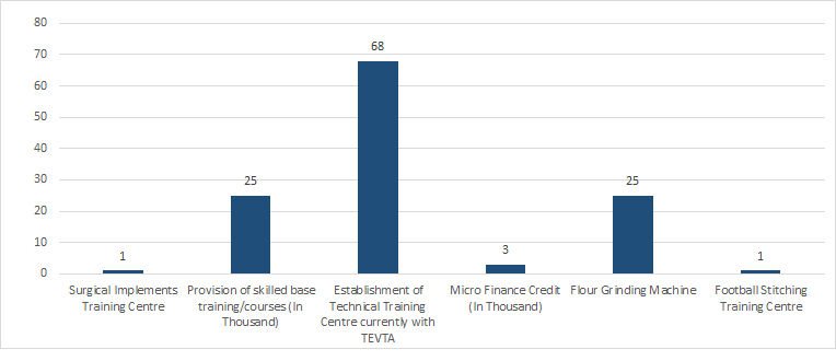
Off-Farm Income Generating Activities
 |
Renewable Energy Sources and Infrastructure Development
 |
GIS and Remote Sensing
ABAD in collaboration with SUPARCO has established a lab equipped with latest technology of GIS/Remote Sensing especially:
- Digital Elevation Model
- Satellite Imagery of Potohar including Mianwali
- Land Cover/Land Pattern
- Licensed Software